

British Isles 1979
$4.99 USD
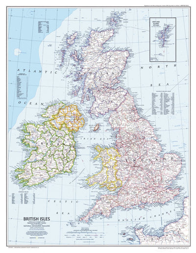
This attractive map of the British Isles, published in October of 1979, accompanied the map of Medieval England in the same issue. In addition to places of interest such as ruins and battle sites, this map also includes ferry routes.
Geographic area:
Category:
Educational
Size:
46.73MB
Publication:
1979
Language:
English
Map bounds
Check nearby mapsWhat you get with Avenza Maps

Reliable mapping tools
Record GPS tracks, add placemarks, add photos, measure distances, and much more.

Locate yourself with GPS
Avenza Maps offline GPS app on your mobile device can locate you on any map, without WiFi or network connectivity.

The best maps by the best publishers
Download professionally curated digital maps on the Avenza Map Store from the best-renowned publishers.